Humminbird Autochart Pro Europe
Short Description
Humminbird Autochart Pro Europe
HUMMINBIRD AUTOCHART
Leave no waters uncharted.
roprietary software from the new Humminbird AutoChart uses your Humminbird’s sonar returns and GPS to build your charts
Simply record that information onto the AutoChart Zero Lines map card (included), import that data into the AutoChart PC program which will convert it into a lake map.
Once complete, transfer your new custom map back onto the AutoChart Zero Lines map card and it’s ready to display on any compatible Humminbird.
No subscriptions.
No hidden fees.
No need to submit your data and wait weeks for a finished chart.
AutoChart does it instantly – and your data is kept private, so your competition is none the wiser.
€383.90
Product Details
Overview : Humminbird Autochart Pro Europe
RECORD SURVEY DATA
Travel back and forth then up and down water in a zig-zag pattern with your Humminbird in record mode.
CONVERT YOUR DATA
Transfer the saved survey data from your Humminbird to your PC via the AutoChart Zero Lines map card (included). AutoChart will convert that data into a detailed map.
EXPORT YOUR MAP
Save the newly created map back onto your AutoChart Zero Lines map card for use in your Humminbird.
ZERO LINES MAP CARD
The Zero Line is the place where the water meets the shore.
Humminbird AutoChart includes a map card loaded with Zero Lines for millions of water bodies.
With these all-important Zero Lines as your foundation, you can begin creating your own accurate and detailed maps of any fishing spot.
The Zero Line map card is also formatted to record your sonar logs
After recording, load the card into your computer to let the AutoChart PC Software convert the recordings into a map that can be displayed on your compatible Humminbird.
DVD PC SOFTWARE
The AutoChart DVD software for your PC is the powerful engine used to turn survey data into a sophisticated lake map.
The map created by the AutoChart software can be viewed on the computer AND be exported back to the Zero Lines map card to be viewed on you compatible Humminbird unit.
Now you can have your own map for that secret honey hole and keep it a secret.
FOLLOW THE CONTOUR
With i-Pilot Links innovative Follow the Contour feature, it directs the trolling motor to follow a specific depth contour.
The chosen contour line can be automatically followed in either direction, or stay a set distance from it or the shoreline using the Contour Offset feature.
Visit the i-Pilot Link page for more info: http://www.humminbird.com/Category/Technology/iPilot-Link/
I-PILOT LINK IN ACTION
This screen shot shows a contour selected and i-Pilot Link automatically guiding the boat along its course.
This incredible feature is now available on what was once previously unmapped water- when data is surveyed and converted using AutoChart.
Humminbird Autochart Pro Europe
https://humminbird.johnsonoutdoors.com/mapping/autochart?_ga=2.44147491.626910511.1587071554-144227098.1587071554
Related products
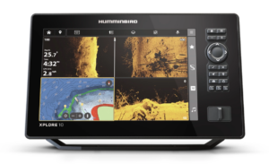

Humminbird XPLORE 10 CMSI+
€2,050.00 – €2,350.00 Select options This product has multiple variants. The options may be chosen on the product page- Sale!
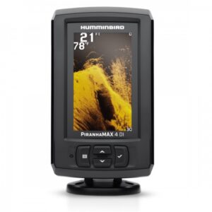

Humminbird Piranhamax 4 DI Fishfinder
€329.00Original price was: €329.00.€299.00Current price is: €299.00. Add to cart